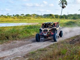
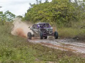
Colorado is a beautiful state with hundreds of lakes, towering mountain vistas, and wide-open valleys. You can find terrain for every level of off-roading from beginner flat terrain and easy-rolling hills to rock crawling and even some areas that offer mudding opportunities. No matter what your preferences are, you will be able to find the perfect Colorado trail.
Table of Contents
What to Know Before Riding UTVs in Colorado
It would be best if you had your vehicle registered with the Colorado Parks and Wildlife in order to travel the trail systems in the state. You can do this from their website.
It is also essential that you make yourself aware of not only the state but also local county and city laws regarding off-road driving. Some trails may even have their own policies, so be sure to read any signs that you may find as you drive.
Most of the trails only allow off-roading vehicles with a width of fewer than 50 inches, so you will want to check before bringing any crew size UTVs out to ride. Trail specifications are listed on the United States Department of Agriculture and Forest Service website.
The Best UTV Trails in Colorado
There are hundreds of unique trails and trail systems throughout Colorado, but we have narrowed them down to some of the most extensive, well maintained, and versatile locations.
Apple Tree Canyon Trail
https://www.fs.usda.gov/recarea/lincoln/recreation/ohv/recarea/?recid=34310&actid=93
Size: 5.1 miles
Area: Near Cloudcroft, CO
Terrain: Mountain and some lowland brush areas
Details: This trail goes through a mountainous area but has a maintained road throughout. The USDA lists it as “difficult” under their terrain rating. UTVs wider than 50 inches are not permitted, so it is best ridden on a one-seater if possible.
Yearly Closures: No information is listed online about yearly closures or limitations. You can reach out to the Sacramento Ranger District of Colorado for more information.
Wagon Wheel OHV Trail – East
https://www.wagonwheeltrails.org/
Size: 250 Miles
Area: Rio Blanco County
Terrain: Looping wilderness trails, mostly forest, hills, and plains
Details: Beautiful vistas and trail areas that cater to every skill level make this trail a truly one of a kind experience. It has nearby communities and connecting roads leading from the trail.
Yearly Closures: Some trails are closed May 15 to June 20, but you will want to check ahead with the Colorado Parks and Wildlife Service to ensure there are no temporary closings due to weather or fire hazard before making the trip.
Grand Mesa Trails
https://www.coloradodirectory.com/maps/atvgrandmesa.html
Size: 150 miles
Area: Grand Mesa National Forest
Terrain: Lake, forest, hills, valley, and wide-open meadow trails
Details: There are flat top areas of the mountain for anyone new to off-roading, but there are also difficult rocky hills with deep mud holes. There are also many lakes you can visit and flat meadowland within the valley. Grand Mesa National Forest has a little bit of something for everyone.
Yearly Closures: To find out about closures or get additional information, you can reach out to the Grand Valley Ranger District at 970-487-3534.
Engineer Pass Road
https://www.alltrails.com/trail/us/colorado/engineer-pass-road
Size: 20.5 miles
Area: Near Ouray, CO
Terrain: Waterfall and mountain trail
Details: Part of the Alpine Loop, these trails show off a gorgeous part of the San Juan Mountains. There is even a waterfall on the trail for you to enjoy and partially follows a creek where you can enjoy hunting and fishing. The difficulty rating for this twenty-mile stretch is “moderate” with some difficult hills and rocky terrain.
Yearly Closures: Closed during the winter. It is recommended that you call ahead for any weather-related closures by reaching out to the San Juan Mountains Center at 970-387-553.
Red Feather Lakes Trail
https://www.alltrails.com/trail/us/colorado/deadman-road
Size: 22.9 miles
Area: Red Feather Lakes, CO
Terrain: Mountain trails and county road
Details: This is an open, well-kept road which is perfect for new riders. There are also several nearby camping locations so you can make a weekend trip to this lovely mountain location. There are also nearby lakes where you can fish.
Yearly Closures: The trail is closed between December 1 and June 14. Check for weather-related closures by reaching out to the Canyon Lakes Ranger District at (970) 295-6700.
Yankee Hill Trails
https://www.fs.usda.gov/recarea/arp/recarea/?recid=28492
Size: 1.5
Area: Yankee Hill, CO
Terrain: Mountain trails
Details: The area around Yankee Hill has multiple trails that connect with other area trail systems. There are also multiple nearby communities, camping locations, and lakes. The nearest area where you can set up basecamp is Columbine Campground.
Yearly Closures: Not listed. You will want to reach out to the Ranger District for more information.
Hardscrabble Special Recreation Management Area
https://www.blm.gov/visit/hardscrabble-east-eagle
Size: 5.4 miles (connects to longer trails)
Area: Snowmass, Colorado
Terrain: Mountain, forest, hill, and valley trails.
Details: The best side-by-side portion of the trail is near Gypsum, CO. This Alpine ridge trail goes up through the hills and then drops down between the mountain ranges. It features easy level riding. This is a high-traffic location for hikers, runners, and bikers. Wildlife is plentiful in this area with numerous elk and deer. Wildcats have also been seen in the area, so caution is encouraged.
Yearly Closures: Closed between December 1 and April 15. For more information or to find out about weather-related closures, you can reach out to the Colorado River Valley Field Office at (970) 876-9000.
Black Bear Pass
https://www.trailsoffroad.com/trails/2651-black-bear-pass
Size: 9.8 miles
Area: San Miguel County
Terrain: Mountain, meadow, and forest trails
Details: If you want a challenging ride, then this is the trail for you. It is rated as severe, requiring a driver with a high skill level in navigating rocky and difficult trails. If you can make it through, then the area is worth every second. There are meadows of wildflowers, rushing waterfalls, and thickly forested areas teeming with wildlife.
Yearly Closures: Not listed. You can reach out to the Antonito Ranger District to find out about closures and additional information.
Medano Pass
https://www.trailsoffroad.com/trails/371-medano-pass
Size: 12.8 miles
Area: Huerfano County
Terrain: Sand dunes, river, and open trail
Details: If you want to get some dune riding in, then the Medano Pass is the right trail. It follows a river, and there are some hilly areas as well. Located in the Rocky Mountains, this pass takes you right into the Great Sand Dunes National Park. There are additional mountain trail locations nearby as well. There are also nearby camping areas.
Yearly Closures: Not listed. Reach out to the San Carlos Ranger District for closures and any additional information.
Bill Moore Lake Trail
https://www.trailsoffroad.com/trails/219-bill-moore-lake
Size: 5.6 miles
Area: Clear Creek County
Terrain: Lake, mountain, hill, and open trails
Details: Located in the Arapaho National Forest, the Bill Moore Lake Trail features a host of trails that loop around the beautiful lake area. You will find hills, meadows, forests, and mountain trails within this area. The trail is listed as moderately difficult, so it might not be ideal for first time UTV riders. There are campsites available along the trail and around the lake.
Yearly Closures: Not listed. You can reach out to the Clear Creek Ranger District for more information.
Rainbow Road Trail
https://www.trailsoffroad.com/trails/1030-rainbow-road
Size: 3.17 miles
Area: Clear Creek County
Terrain: Mountain and lake trails
Details: This is a gorgeous lake area with hiking, camping, fishing, and off-roading all within the confines of the Rainbow Road. It is only a few miles from the Bill Moore Lake Trail, so you can enjoy both of them on the same day. The road is very well maintained, and this is an easy terrain, so it is perfect for beginners.
Yearly Closures: Not listed. You can reach out to the Clear Creek Ranger District for more information.
Bald Mountain Gulch Trail
https://www.trailsoffroad.com/trails/619-bald-mountain-gulch
Size: 8.8 miles
Area: San Isabel National Forest
Terrain: Rocky mountain trail
Details: This moderate level trail is rocky and features quite a few deep dips and steep hills. There are various nearby trail systems within the San Isabel National Forest and also areas to camp along the trail. There are also commercial campground locations nearby with amenities if you wanted to spend the weekend. The landscape is mostly brush and forest but still beautiful.
Yearly Closures: Not listed. For closures or more information about the area, you can reach out to the Salida Ranger District.
Summary
Most of the trail locations in Colorado are going to involve stunning mountains or deep, clear lakes. No matter which trails you choose, there is an unrivaled number of camping options in this state thanks to the various national parks and recreational lodges which are around year-round. You can find places for all skill levels throughout the various trail systems, from wide-open county roads to narrow rock-strewn paths.
Wherever you intend to ride in the state, make sure that you have a pass for your vehicle and pay any necessary fees required for certain trails and campgrounds. When in doubt, you can always reach out to the local ranger district for more information. It is best to always be prepared before heading out.


